
Mount Isolation - 4,004'
Hike Statistics
Total Distance: 12.3 miles
Elevation Gain: 3,840 feet
Hiking Time: 9 hours, 55 minutes
Difficulty: Difficult
Season: Fall
Hiking this peak in winter? Click here!
Hike date: 10/14/2019
Description: Mount Isolation is a remote peak in the Montalban Ridge and has one of the best views of the Presidentials in the White Mountains. This was our final peak, #48, marking the completion of the NH 48 for us! Using the below route, you’ll have the opportunity to visit Glen Boulder, visit Gulf Peak, make an optional stop at Boott Spur, spend time in the Dry River Wilderness, and cross Rocky Branch River multiple times.
Trails Used: Ascend via Glen Boulder Trail to Davis Path. Take Davis Path all the way to the summit of Mount Isolation. Descend via Isolation Trail and Rocky Branch Trail.
Trail Summary: This hike was going to be #48 for us, so we were really excited for it! If you want to hear about our overall NH 48 experience, check out our blog post about it here. Since we had our friends with us, we decided to do a loop, ascending Glen Boulder to Davis Path, then descending Isolation Trail and Rocky Branch Trail. Doing this loop will require two cars or hitching a ride (which is easy enough to do on Route 16; we have done it numerous times). The distance in between the trailheads is about 5 miles and it’s all uphill, so it would really be a terrible road walk. We parked a car at each trailhead then started at Glen Ellis Falls parking lot, where Glen Boulder Trail starts. Note that if you don’t have a second car or don’t want to hitchhike, you can do this hike as an in and out via Glen Boulder Trail (requires lots of elevation gain on the way out) or an in and out via Rocky Branch / Isolation Trails (very wet and not much to see).
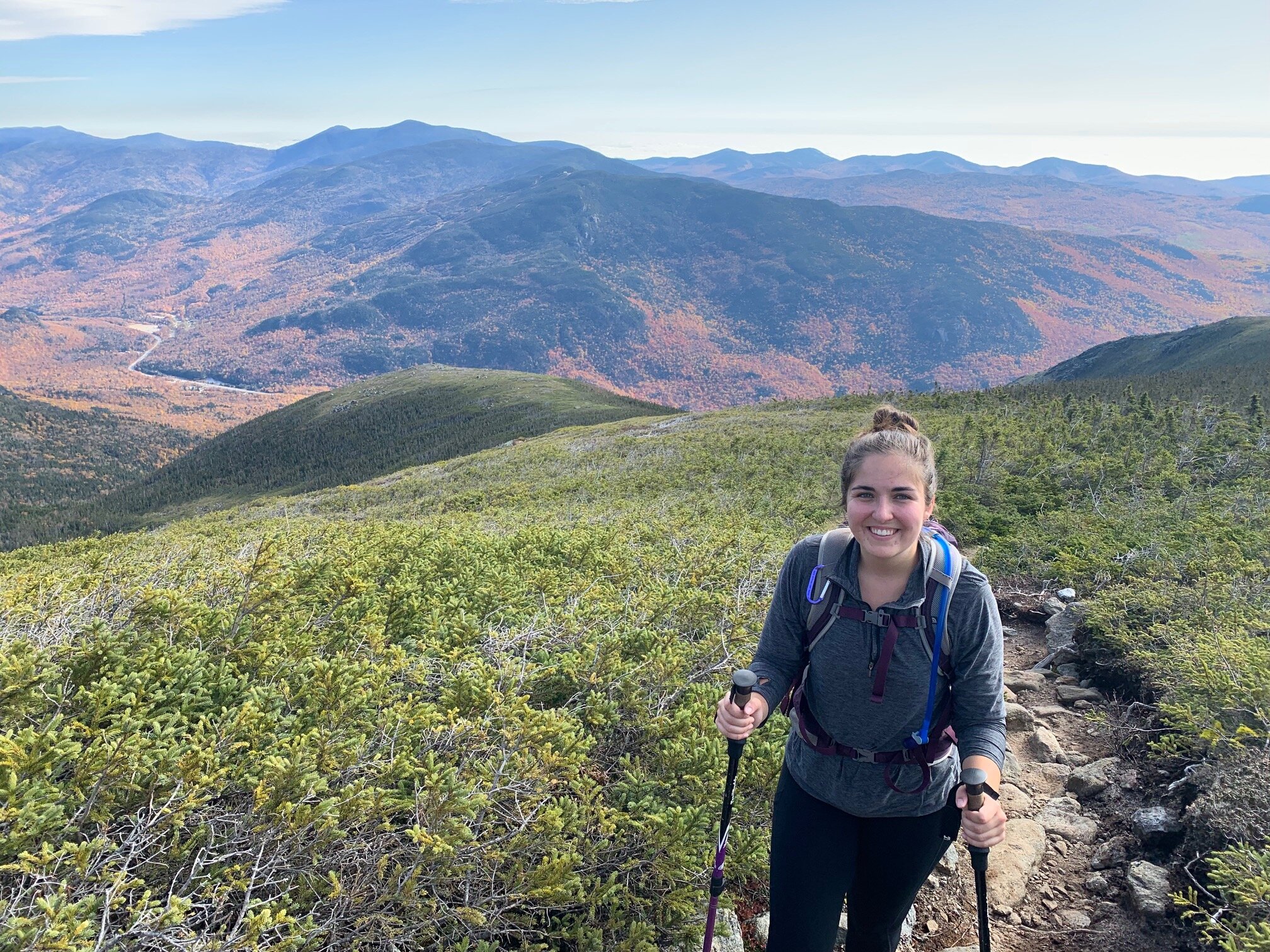
The Glen Boulder Trail is a beautiful trail to hike on, especially in the fall, as you get multiple opportunities for amazing views. The trail climbs moderately to start, but that doesn’t last long. Soon the trail climbs steeply over rocks and you’ll come to a junction with the Direttissima Trail. The trail continues to climb pretty steeply until you reach treeline. As soon as you get above the trees, turn around and you’ll see amazing views of the Wildcats. Since we were here in early fall, the foliage was awesome too. Above treeline, the trail is easy to follow and there is only one difficult rock scramble. In the distance, you’ll see Glen Boulder, a huge rock perched on the side of the mountain. To Glen Boulder, it’s about 1.6 miles and 1,750 feet of elevation gain. We spent a long time here enjoying the views and taking lots of pictures. After Glen Boulder, the trail continues to climb up over rocky terrain at a moderate to steep grade. You’ll enter back into the trees again and remain in them for a while, and the trail continues to ascend moderately. This portion of the trail is very narrow, so be prepared to be brushed by all the trees. About a mile after Glen Boulder, you’ll come back above treeline and find yourself at a Gulf Peak, which has fantastic views of the surrounding peaks. From here, the trail dips a bit then ascends moderately until you come to the junction with Davis Path. From the trailhead to this point, you’ve gone 3.2 miles and climbed 3,200 feet.

The lower portion of the Glen Boulder Trail ascends moderately with lots of rocks

The higher you go on Glen Boulder Trail, the steeper and rougher it becomes

Big scramble right before breaking above treeline

First views of the day from above treeline; Wildcats visible in the back

Looking up at Glen Boulder (left) from down low

Trying to move Glen Boulder… no luck!

Looking up towards Gulf Peak and Boott Spur
Looking back down towards the Glen Boulder area, where we just came from

Enjoying the views to the west at Gulf Peak; Mount Isolation is in the distance

Approaching the junction with Davis Path. The trail ascends moderately here on easy terrain

The junction with Davis Path! Good spot for a break with great views
We enjoyed a nice break at the junction, and the excellent views. If you take a right at this junction, you’ll be at Boott Spur in 0.5 miles (optional side trip). This was not our plan though, so we headed down Davis Path (which you’ll descend about 1,200 feet on). Note that this portion of the hike (as well as the portion on Glen Boulder Trail) remains above treeline for a decent amount of time, meaning you are completely exposed to the weather at all times. Make sure you have warm layers even if the sun is out! While hiking on Davis Path, you’ll be on a mix of dirt and rock. You’ll see a lot of down trees from storm damage, and there are a lot of muddy sections too. Davis Path starts by descending at a low grade, but then descends very steadily as you enter back into the trees. After some time, you’ll reach a junction with the Dry River Trail. Make sure you stay on Davis Path / Isolation Trail East here (the two trails coincide here). In 0.3 miles, you’ll come to another junction with the Isolation Trail (east). This will be your descent, so for now make sure to stay on Davis Path and follow the sign towards Mount Isolation. This portion of the trail was very muddy. In about a mile, you’ll come to a sign that marks the spur path to the summit of Mount Isolation. The spur path climbs steep and quick over ledges and rocks to the summit of Mount Isolation. At the summit, you’ll find incredible views in almost every direction.
Since this was #48 for us, we had to celebrate! Our friends brought a bottle of champagne and made us tortellini salad for lunch. We also brought blueberry soda, which we love. We lucked out with the weather and had blue skies with minimal clouds. After enjoying our food and drinks, and taking lots of pictures, we began our long descent down. Head back down the spur path to get back to Davis Path and take a left when you come to the trail. Hike out for a mile back the way you came. You’ll reach the junction with the Isolation Trail quickly, as this part of the trail is relatively flat. Now, you’ll head down the Isolation Trail towards Rocky Branch.

Entering the Dry River Wilderness as we head down Davis Path

Looking down towards Mount Isolation as we are about to head back into the trees

Lots of storm damage is evident on Davis Path. The trail is never too challenging in terms of terrain

One of the tricky junctions: make sure you stay on Davis Path by bearing left here

Junction with the Isolation Trail. Go right towards Mount Isolation. You’ll come back here after the summit and take Isolation Trail down

Davis Path heading towards Mount Isolation is relatively flat and easy terrain

Spur path to the summit of Mount Isolation. Quick climb and you’re at the top!

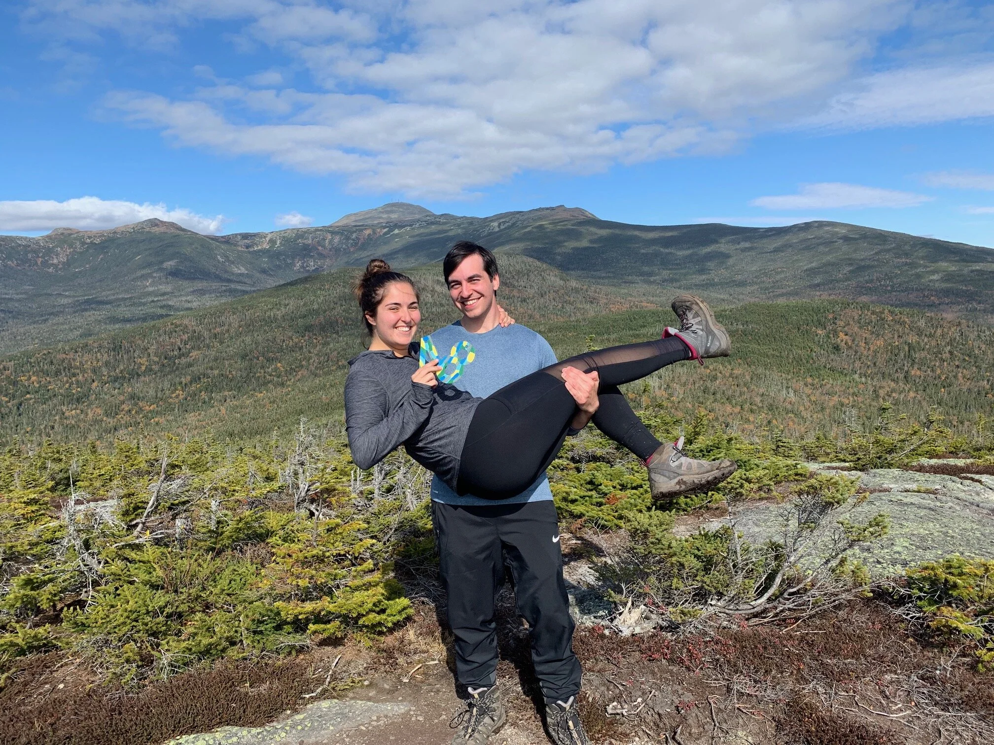
We did it! #48 on Mount Isolation. Crystal clear views of the Presidential Range ahead of us

After our photo shoot, it was time for some food and drinks to celebrate finishing the NH 48!
The Isolation Trail tends to get a bad rep as a miserable trail, but we really didn’t find it that bad at all (though it could be because we went down it instead of going up it). The trail descends very easily, but over lots of wet and rocky footing. While descending the trail, you’ll have four river crossings to deal with. The first three (coming from a descending direction) are rather easy to cross since there are lots of rocks. The final crossing is a bit bigger, but still isn’t too difficult to get across. We all managed to stay dry on these crossings. Do note though, after heavy rainfall or in the spring, these river crossings may become very treacherous and much more difficult to cross as the water level is higher! The Isolation Trail as a whole is narrow and rough (footing and route finding can be tough), so use caution. The water crossings are marked by cairns, but make sure you remain on the trail and don’t wander down a spur path. As long as you have good waterproof shoes/boots, all of the water and mud on the trail shouldn’t be an issue. After descending the Isolation Trail for 2.6 miles (and dropping only 1,000 feet in elevation), you’ll come to the next junction with the Rocky Branch Trail.
At the Rocky Branch junction, you’ll want to take a left and immediately cross the river (follow the sign for Route 16 - don’t go straight at the junction). This is a pretty good sized crossing, but like the others, it’s not bad with low water levels as there are lots of rocks to hop on. Once you cross the river, be very careful as the trail can be easy to lose. The trail is marked poorly and there are lots of spur paths leading to campsites. After the crossing, immediately go left and you should be able to find the trail. The trail then begins to ascend easily (~300 feet of elevation gain) as you cross over Engine Hill, though be ready for lots of rocks and wet areas on the trail. You’ll then begin descending moderately before reaching a very straight portion of the trail that ascends on a slight uphill grade. After this, the trail then drops very steadily at a moderate grade through the woods. This portion of the trail has several switchbacks through the forest and the trail is mostly dirt with some rocks, making for a nice descent after a long day. After 3.7 miles from the Rocky Branch junction (and an elevation loss of 1,950 feet), you’ll reach the Rocky Branch Trailhead. Here you’ll either have your second car waiting for you to take you back to Glen Ellis Falls parking lot, or you can walk down to Route 16 and hitch a ride from someone heading northbound.

The upper portion of the Isolation Trail is very wet and rocky, and descends very gradually
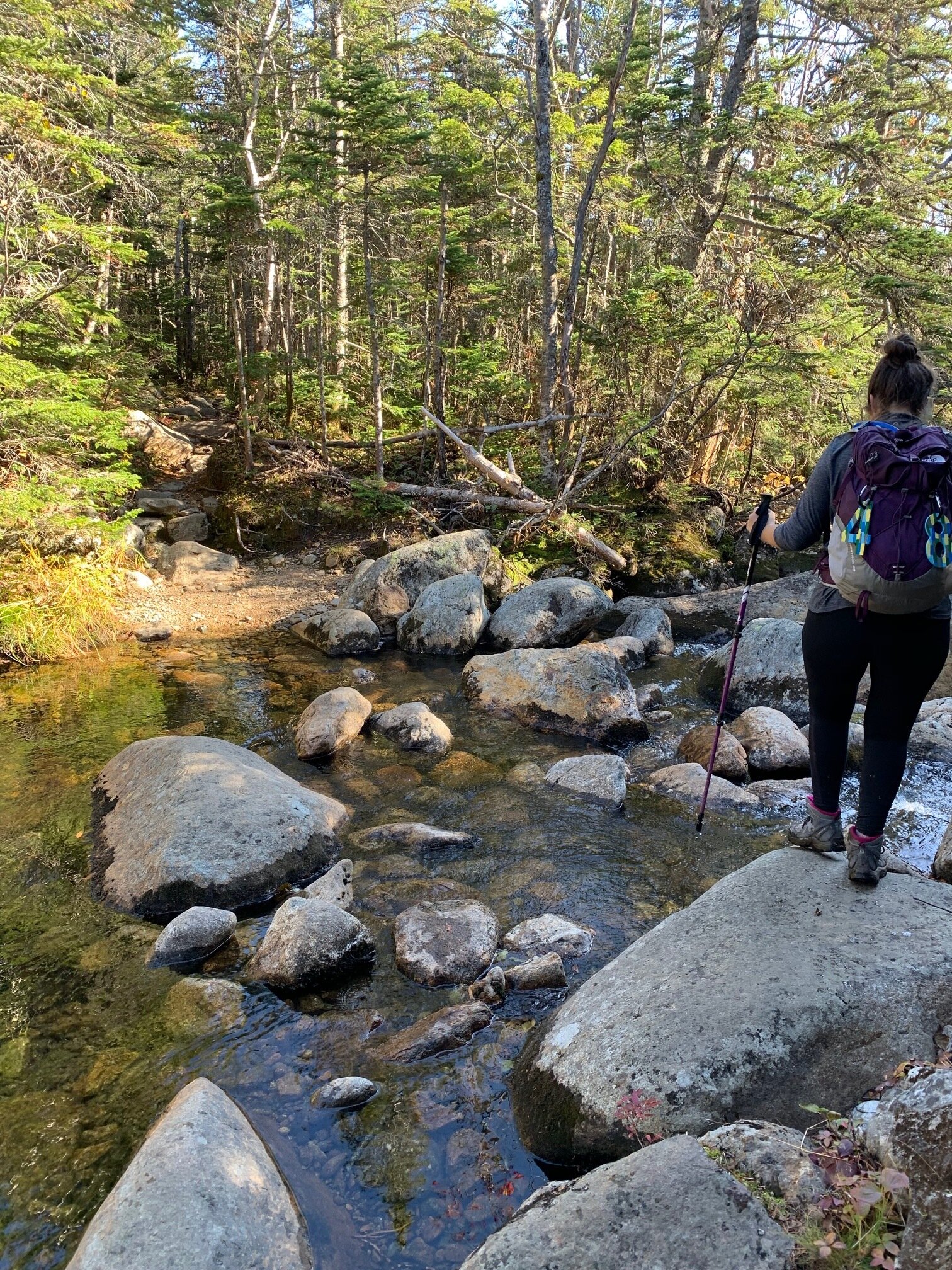
The first river crossing (from a descending direction)

Second river crossing on Isolation Trail

Third river crossing on Isolation Trail

The last (and biggest) river crossing on the Isolation Trail

Junction with Rocky Branch Trail

The major river crossing on the Rocky Branch Trail, immediately after the junction

We were lucky to see lots of nice foliage as we got lower

The Rocky Branch Trail descends very gently over easy terrain

As you get lower on the Rocky Branch Trail, you will start to descend at a more moderate grade over easy terrain
Alternative routes:
We have not yet done any alternative routes to the summit of Mount Isolation. This page will be updated once we have!
Hiking Mount Isolation in the winter

We have not yet climbed Mount Isolation in the winter, but once we do, we will update this page with our full report!
Questions? Comments? Want to share your take on this hike? Get in touch with us using the contact page!


As experienced hikers, we always make sure that we are hiking with The Ten Essentials which include navigation, a headlamp, sun protection, first aid, a knife, shelter, extra food, water and clothes. Overtime, we have discovered some items that we always bring on our hikes and consider them to be our personal, expanded ten essentials.